Chapter 2: History
Reviews the history of Perry Lakes since European settlement. Vegetation and water level regimes within Perry Lakes over the past century are reconstructed from botanical, air photograph, water level and flood remediation time series and anecdotal records. Historic records of climatic and groundwater changes in Floreat-Wembley area are reviewed. Chapter 2 includes historic photographs of Perry Lakes dating back to 1921. A more extensive (and better quality) gallery of historic photographs is available here.
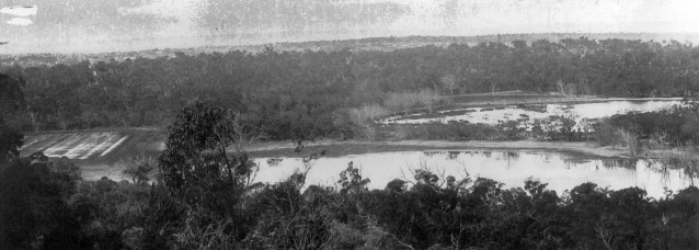
Panorama taken in 1921 from One-Tree (Reabold) Hill over West Lake (foreground) and East Lake (middle distance on the right). The photo was taken during one of the wettest periods on record. Dead mature trees around both lakes suggest a recent rise in water levels. Formal water level monitoring at Perry Lakes (West Lake) commenced in 1963. Copyright holder unknown, reproduced by permission Town of Cambridge.
Storm water drains were constructed into the lakes in 1954 and extensive stripping of natural wetland vegetation and bank re-contouring comprised part of a ‘beautification’ program preceding the 1962 Commonwealth Games. Modification and degradation of the wetlands however dates back to the mid 1800’s when they were used for watering livestock. At low water levels remnants of old tree stumps and post and rail fencing are evident in both lakes.
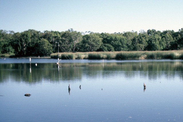
View looking west across the southern basin of East Lake. White PVC pipes are thermistor strings, and surface, mid-level and bottom temperature loggers. The anemometer mast is visible in the centre along with remnants of fencing and tree stumps, foreground.
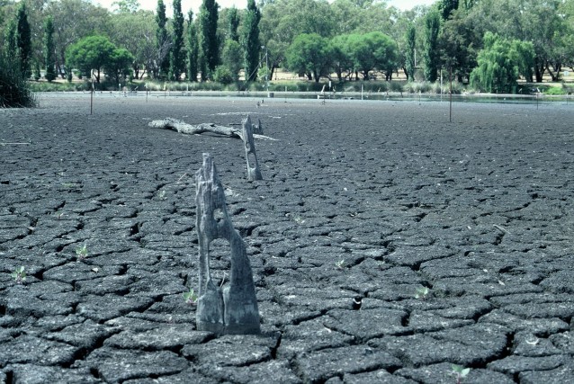
Remains of post and rail fencing, East Lake. During summer the lake is artificially maintained. Towards the approach of summer 1998 the wetland managers let the lake approach total dryness to assist with our lake-aquifer interaction studies (Refer Chapter 7).
The data and photographic evidence suggest that the fences date either from Joseph Perry’s ownership (1880-1917) or the Birch brothers (1869-1880) who are known to have constructed extensive rail fencing. The trees most likely represent a period of sustained low summer water levels co-incident with dry conditions from at least 1876 (when records commenced) until about 1916. During this period only the central portion of the Southern Basin in East Lake sustained permanent inundation.
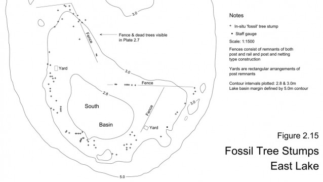
Post and rail fencing and stumps from trees which colonised the lake basin during a very dry period in the 1800’s. Stumps are frequently preserved along the fence lines suggesting they grew while the fences were still serviceable. Similar fence remains occur in West Lake.
The fences were most likely constructed to prevent cattle becoming bogged in the mud. Their remains serve as proxy indicators of a dryer climate that preceded a much wetter period from 1920 to 1960.
